Eastern North America Tour Y2K
Day 70: In the morning, I get an early start. I have no opportunity to use a restroom, so I have an added incentive to get moving. In Freeport, I find a comvenience store where I can get a V-8 and use the restroom.
I notice today a pattern to shoulders in Illinois, at least along this highway. In town, the road is usually two-laned without a shoulder, then at the edge of town is a nice shoulder which completely disappears once the town is past. Fortunately, Illinois motorists are cooperative and almost always slow down when passing. I have a good tailwind that makes the journey easier and keeps my average speed high. The terrain between towns is generally flat with cornfields on either side.
At Polo, I stop at the library and use the internet and discover that Steve K. is willing for me to stop at his apartment in Peoria. I write down the information, and email him to say that I'll take up the offer, planning to use the internet again in Dixon. Every town of any size in Illinois seems to have a library with internet access.
As I am leaving the library, two children appear, almost fighting over a bicycle. The woman following the children tells me of several cyclists in her family and wants me to visit a local minister who is a cyclist. Before we can talk long, one of the children grabs the bike, and they take off, so she pursues them. By the time I start down the street, they are not in sight. I find the minister's house, but no one answers the door.
My plan is to wait out the noon heat in Dixon and use the internet more there, but when I reach that town, signs in the library say that the internet is not available. There's some talk in the library about the Reagan Trail, which is newly initiated, but it seems to be an auto route. The librarians are extremely patient with a young patron who has speech and/or learning problems.
I leave the library later than I intended, but making miles is easy. At Ohio, I ask at the store if I can camp in the park, and the young fellow there really agrees. On the way to the park, I stop to use the phone to call Steve and get additional information. We agree to meet at a small shopping center at 6:30 PM the next day.
At the park, the local kids are playing softball, and even though I never pay attention to sports, I am happy to watch their game. The kids have a wide range of age and abilities and are of both sexes, yet they play well together. Someone arrives to check out the park, and I confirm that it is OK for me to camp there.
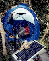
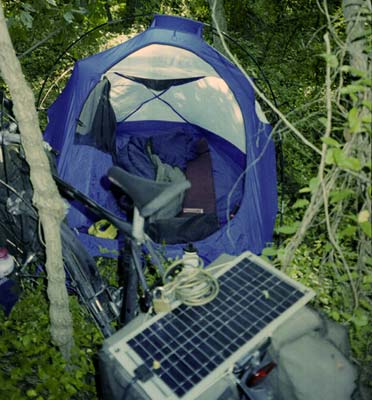
Before getting in my tent, I realize that I have elecricity available, so I use the laptop as darkness falls and then head to the tent (behind the restrooms so it can't be seen from the road) for the night.
Cedarville - Ohio, 64.9 miles, 13 mph, August 9.
Day 71: In the morning, I dry my tent and type up some more events before starting rather late. The man cutting the grass stops to talk to me, and I see he has had an operation on his layrenx which must make talking painful. Nonetheless, he is pleased to have a chance to talk with me about Alabama, where he was stationed for a while at the end of WWII. Another man arrives, and they open the restroom for me.
I get into Princeton at ten, having just traveled 13 miles. All I find at the two supermarkets that I want to buy are some very inexpensive plums. I get a sub, and I go to the library. I read and copy Steve's directions onto a piece of paper, and then waste some time in the library, planning to leave at noon.
For some reason, even though I have found nothing worthwhile to read, I keep wasting time in the library, and it is 1:30 when I am ready to leave. Then, as I get ready to leave, a man wants to tell me about his experience with selling tractors. I immediately recognize his need to share his experiences with others, and I am unwilling to tell him I'm busy and have to rush off, as also I recognize that he -- like me -- has something to talk about and no one to talk to. So, we talk about tractors, even though he is causing me to leave late. Then, when I finally get outside, he pursues me, and we talk some more.
I really can't blame him for my leaving late. I should have left over an hour earlier. However, the extra delay is going to mean that I have to ride without a rest.
I ride straight ahead out of town, taking country roads for most of the afternoon. These roads are better paved than the main roads, although somewhat narrower and lacking shoulders, but they are not well-marked and perhaps could end.
At Tiskilwa, I eat half of my plums at the park and check my route on the laptop, using the plug under the town's pavillion, as it's rather unclear whether I should go left or right (the map shows straight ahead). I also get a soft drink in town.
Fortunately, I have a good tail wind, but there are a number of steep hills. But I push as hard as I can and keep my average speed above 14 miles per hour, even when cycling into a cross wind. One road is closed, another has been recently graveled, and I get worried about where I am, but otherwise the trip runs smoothly. When I feel my energy is dropping, I look for my plums to discover them missing. Either I left them or they fell out along the road. I finally discover my highway and still have enough time to make it to my destination. After many miles, I finally find a drink machine and get another soft drink to get my blood sugar level back up.
As I arrive at an intersection, I find two cyclists there, one evidently having trouble with his front wheel. I stop to help, but he's OK, and they tell me I just have to climb the hill. I arrive at the mall to find Steve waiting, about six minutes ahead of schedule.
He takes me to his apartment, and our conversation jumps from one subject to another. He is an electrical engineer, and he has created a circuit that charges batteries from his hub generator while it powers his lights, so he has light even when he stops. It's a great idea, but he tells me that the circuit is fairly complicated and not easy for the average cyclist to put together.
Steve cooks some good spagetti for us to eat, but I have to cook some additional rice afterwards, as my appetite is huge.
Ohio - Peoria, 61.1
miles, 14.4 mph, August 10.
Day 72: In the morning, we get started somewhat after seven, as Steve has to get to work. I find a supermarket for some cheap donuts, and then I travel across Peoria, not hitting much traffic. I don't have a great deal of drive and am sleepy, as I did not sleep soundly.
The bridge across the river is extremely steep, but I have no problems. On the over side, I get too hot, so I spend some time in a supermarket and in a library, but I don't finding anything to keep me in the library, other than some photos of infants, as the internet is not available.
I continue on my way, but I stop to eat again at Perkin, and then I visit the library, which is dedicated to Everett Dirkson. There I can use the internet briefly, and in looking for something to read, I find another book on the gospels which I find extremely compelling and absorbing. I am unwilling to leave until I finish it, which I do at about 5:00. Then, before I leave the library, I eat outside some of the food that I bought.
I have no problems with my evening run, and I plan to stop at Mason City, where perhaps I can camp. Indeed, when I get there, I find it is getting very near dark, so I consider it unwise to move on to the next town. However, the town is bigger than I thought, about 2,500, reducing my chances of getting permission; it's the smaller towns that let me camp; not the big ones. In town, I find where the park is located, and I am heading there when I see a small motel. I now don't believe that the police will allow me to camp, since a motel is available, so I get a room, hoping the price is not too high. But the charge is $35, the cheap motel evidently a thing of the past.
To make me feel a little more blue, the town is on the Lincoln exchange, and I don't have an internet connection in Lincoln.
Peoria - Mason City, 53.2 miles, 13.8 mph, August 11.
Day 73: In the morning, I type up my accounts of a couple of days before leaving the motel, leaving at about nine. I make the decision to go through Lincoln rather than through Springfield.
I find the supermarket and get some food at nice prices, and I ask two people if the road to Lincoln is on Main Street, and both say yes. I follow Main Street, and the road makes a couple of bends before leaving town. It's not in good repair. After going a few miles, I find myself on highway 29, which goes to Springfield. I decide to continue on to Springfield but then to check the computer map at the first opportunity, which I had toyed with doing at the motel.
A look at the computer map at my first rest stop discovers the reason for my mistake, although looking at the map before I left would not have instantly cleared up the matter. My assumption, based on the roadmap was that I had come in on 10, the road to Lincoln. Therefore to continue on to Lincoln, I only needed to continued on down 10. However, I had actually entered town on a north-south street (Main Street),and the street the motel was on was an east-west street with another name which is highway 10. However, this street is the main street in town. When I asked people if I should take Main Street to get to Lincoln, I'm sure they thought I meant "the main street."
The trip to Springfield is ten miles longer than the trip to Lincoln, which will give me some extra distance before my noon stop.
After leaving the shelter, I ventured on towards Springfield. The traffic is not as bad as I feared. I stop once again to get an icee before I reach town. In town, I quickly find a supermarket and sit at a table inside to eat lunch, which includes a little cooked chicken (usually too expensive).
I find the roads downtown confusing, as I have to leave my route, and the map is no help. A cyclist gives me exact directions to the Lincoln Library, where I use the internet briefly several times and try to read. I failed to look at the time when I came in, and I find myself nodding as I try to read and having trouble keeping focused on the text. People sitting next to me suddenly disappear and others suddenly appear. A girl starts dropping coins from three stories up, and I alert the staff, so they catch her and give her a little lecture. Suddenly, it is five o'clock and time for the library to close. I must have fallen asleep several times!
I am angry at myself for having wasted so much daylight; on the other hand, I know how tired I was, and now I feel more refreshed, so maybe my napping was OK if it didn't disturb others. It's very unclear to me as to how to leave town, as my route left me, traveling over restricted highways, so I just keep traveling east and south, trying to keep to the larger road. A sign directs me down an obscure road to a supermarket, and unable to resist, I go there and get some more food. Coming out, I look at the road in front of the store and decide it must be my route (highway 29).
As I leave town, I notice a bikeway running parallel to the highway and two cyclists using it. So I cut across some greenspace and catch up with them. At the next intersection (and end of the bikeway), we stop, and I get into a conversation with them and another cyclist, who arrives at the same time. They tell me that there's a place to camp beyond Taylorsville.
Then I take off for Taylorsville with less than two hours in which to cover the distance. On the way, I stop at a small town for a drink and ask the clerk about camping in the park, but he reacts so negatively that I head on. Traffic is heavy all the way, which does not help. I keep watching the tree line on the right, where a railroad used to run, hoping I'll find a cluster of trees where I can camp. I stop at a stream crossing, as there are lots of trees there, but the ground between me and the old railroad bed is too steep to cross.
It's getting dark as I enter Taylorsville, and I know I can't make it to some lakes ahead, where I'm supposed to be able to camp. I see a wedge of trees just before Wal-Mart, so I stop and walk in, and it is barely suitable. Because a constent stream of cars is passing in both directions, I decide I need to waste some time, and remembering that I need batteries, I ride down to Wal-Mart, where I first buy batteries, and then finding my flashlight doesn't work, buy a new flashlight also. By that time, it is quite dark and the stream of traffic has ended, so I ride back to my spot and get off of the road without anyone seeing me.
Unfortunately, I pick a slightly different place to walk into the woods, and my bike immediately falls into a deep hole. Next, I have to lift it over a log, and then balance it across another log spanning a second hole, with all kinds of vines and briars fighting me. However, I don't wish to retreat to the roadway, so I persevere.
Finally, I lean the bike against a tree and begin to put up the tent. While doing so, I am bitten by mosquitoes and scratched by briars, so I am a little frantic. But once I get inside, I find few insects, and the ground is soft enough, so I have a good night, although I hear some animals moving around in the dark.
Mason City - Taylorville, 59.5 miles, 13.1 mph, August 12.
Day 74: In the morning, I discover that my socks are just covered with stickers and burrs. I get my tent up and leave without anyone paying attention and head out of town, stopping only for a V-8 on the far side.
I continue some 20 miles down to Pana, where I have my first real break, stopping at a grocery for a sub, some yogurt, and some bananas.
I then ride another 17 miles to Ramses, a very small town, which I reach right after lunch. Needing something solid to eat, I go to the park, which has only a couple of torn-up tables but lots of room for horse trailers and an area for a rodeo. There I cook some beans and rice and take a very brief nap while horse trailers, horses, and horse riders appear. This is the first time I've cooked since before Peoria.
In the afternoon, I ride down to Vandalia, arriving at about four. I get a sub and check the library, but it doesn't open on Sundays. The sky has turned awfully dark, but I continue anyway. Rain is not much of a threat now that the weather is so warm.
Along the roadway, I am noticing patches of trees, so I am hoping for a camping site in the woods. The last few parks have had signs indicating daylight use only. Some miles out of town, I find some woods on both sides of a creek. I first check to see if I can get under the bridge or down to the woods on that side, but the grass is too high and thick. I go back up the hill to the north, where I first saw an opportunity, but I now notice a roof farther back that wasn't visible on the way down. I ride up the other side to the south, and I find that there is no house there, although there is a lumberyard on the right. Before the top of the hill, there was a lane going back into the woods on the left posted "no hunting," so I go back and examine that. It is a route through a bit of woods to some fields. I push my bike up the road, but I turn off of the lane and up the hillside on my right. The time is only five o'clock, and I feel funny about stopping so early. However, it is a good place, and I have come far enough for one day.
Taylorville - Vernon, 61.9 miles, 11.6 mph, August 13.
Day 75: Although I was awake a number of times, I had a good night's sleep, dreaming about bike paths and teaching in South Georgia.
When I get fully awake, I can hear that the lumberyard is running at full speed, although it's not yet seven o'clock. But then, work was underway last night after five on a Sunday.
When I start, I discover that the wind is pushing against me. I pass through Vernon, just down the road, but there is no place to get food or drink. I had eaten two of my three bananas during the night, so I am feeling hungry. Patoka is off of the road, although the map shows otherwise, so I continue on. Finally, I must take a breather, so I stop at a wayside rest, which is only the second or third I've seen in Illinois on this trip. The rest stop has some new tables but no john and no water. I have nothing to eat, and my water is almost gone. Fortunately, if the map is right, the curve ahead indicates that I've nearly reached Sandoval, so I ride on after a brief rest.
There I get a drink and a small packet of donuts, as everything else is too high for my budget or unsuitable for my diet. I then explore the town, wanting to find a grocery, and find it back on the main road, after I've given up on the town. I get some cheap plums and other fruit but still no bread, as I am still letting the lack of fresh bread bother me.
Then I start towards Central City/Centralia, just six miles away. There I have trouble finding the library and then find that it is open only in the afternoons, despite having a full staff at work in the mornings. A woman coming out says they need the mornings to get their work done and then can't open until after lunch.
I find some more food at a small grocery and get another 32 oz. drink to nurse as I travel along. I'm rather dissappointed with Centralia, and I hope I can find a good library in Vernon.
The road here is the first good highway I've seen in all of Illinois. However, I leave it as I turn south. It's a very hot day, and I make it as far as Dix before getting some potato salad for lunch (I have tried to avoid potato salad due to the fat in it, but it's the only cheap carbohydrate here). As there is absolutely no shade outside where I can eat, I ask if there is a park, and two of the townspeople give me directions to the place where the town intends to build a park someday. So, I ride down there, and I am about to turn around as the road looks like a dead end, when a car pulls into the drive behind me and the second townsperson, a woman, gets out and tells me to go on.
Well, it's actually a nice site for a park with large, pretty maples. I eat my potato salad and then take a short nap. When I am ready to leave, it is almost four.
I ride into Mt. Vernon on a terribly narrow road with curbs; it must have been built at least 50 years ago. I get a sandwich and find the library, but there seem to me no internet computers. I find a good book that I'm anxious to read and immediately am told that the library will close in 20 minutes. I read a little, but the next announcement is that the library is already closed. Leaving the library, I get a sub and then leave town.
Traffic is heavy going south, with lots of tractor-trailers. This surprises me because my road parallels the interstate; however, when I get close enough to see the trucks on the interstate, I notice that they are not traveling much faster than I am, which explains why my road is getting so much traffic.
I know that there is a state park ahead, but there are lots of woods nearby, even though I am between the railroad and the interstate. I see one good patch of woods but ride by to check if there are nearby houses. Opps, there is a campground, so I better go on. I stop at Ina and ask about the state park, and the boys volunteer that there's lots of local woods to camp in.
Further on at a boat launch site, I find some info about the lake being US Corps of Engineer property and rules about its use. Campground rules are listed, but nothing saying that other camping is not allowed, and the only places closed at night are the picnic areas.
A short distance down the road, I find a low guard rail near the lake. I lean the bike against the guard rail and check out the woods. I come back and lift the bike over the rail by staying on the opposite side, grabbing it by the handles on the front and rear racks, and letting the rear tire rest on the rail as the bike crosses over. It's not even a strain. Then I push the bike into the woods and pick my camping spot. Unfortunately, I can't get to the lake here due to lots of small trees on the shore.
It is very hot inside the tent.
Vernon - Reed Lake, 64.4 miles, 11.9 mph, August 14.
Day 76: The sun was red as it set behind the trees last night, and it is red as it rises through the trees this morning. I eat my bananas, get up and pack, and push my bike to the road. To get it over the guard rail, I use the same tactic as last night, only standing on the opposite side of the rail today. As the rear tire goes over, I notice that it is completely flat.
I lay the bike down and inspect the tire, but there is no sign of a nail or piece of glass. I bet one of the thorn bushes I ran over last night did it. I set the bike up and inflate the tire, and there is no sign of escaping air. Well, I'll just watch the tire and see how it behaves. Sometimes a small hole will get worse, and sometimes it will get better. I've already had one hole disappear on this trip.
At the next intersection, I reach a junction with my 1990 route. I am now going to follow the same way, only avoiding two mistakes I made before: 1) not getting food in Benton, and 2) missing the turn to Eldorado.
At the first intersection in Benton, I ask about the store and discover that it is on the road to the east, behind some other buildings. No wonder I missed it. I get mostly fruit at the store, including half a cantaloupe, which will help on a hot day. While leaving, I see a man get out of his pickup who seems to want to talk to me, so I stop and he says, "You know, I can hardly recognize you with that beard." Obviously, a case of Alzheimer's or dementia.
The weather is very hot, so I stop to eat the cantaloupe before the next town. There I finally get some bread -- buns, actually -- and make some peanut butter and banana sandwiches, the first since the east coast. At another store, I fill my bottles with new water, and I fill my main bottle with softdrink and ice.
Before going five miles, I stop in the shade of a run-down restroom next to a playing field in Galatia to cool off. My average speed is good, the wind is slightly in my favor, but I have to watch for heat-related problems. Even after a good pause, while resting in the shade with a good breeze, I am wet with perspiration. But not miserable.
I then ride another four miles up the road to Raleigh, where I carefully make the turn to Eldorado that I missed ten years ago. As a result, I then followed a completely different route to Cave-in-Rock than I am now taking. I stop at the little store in Raleigh for a little drink, and the owner wants to talk, so we talk about this and that, relating pretty well, I think, until he suddenly says, "Do you want that bottle filled with water, or do you want me to throw it away for you?" It is a dismissal, and the conversation has suddenly ended. There have been customers coming and going, and he did not stop talking for them, and there are only two in the store now. One leaves while I am getting water outside, but as I look inside, the owner and the other man are no longer visible.
The ride to Eldorado is just four miles and wouldn't be bad if it weren't for the trucks. As I arrive in Eldorado, I am going up a steep hill with no shoulders and a truck coming up behind me, so I give up and pull off onto the grass to find myself in a park with a shelter. So I check out the shelter and see it has electricity, although the plugs are mounted very high to make them unnoticeable. I decide to sit there and type up some of my account, and I have a swimming pool a hundred yards in front of me to provide some distraction when I want it.
However, two boys and then a third come out of the pool and start messing around the shelter, one peeing on the ground in front for whoever wants to watch. I decide to be patient and maybe they will leave, and I am just about rewarded when the pool lets out, and now I have half a dozen kids hanging around and asking questions. One bright kid figures out the solar panel right away. I don't dare hook up the cord as someone is sure to trip over it; besides, how can I write with this much distraction? I decide to wait out these kids, but one of the parents failed to show up, so I am not going to be alone for a while, and therefore I decide to leave. At the bottom of the hill I find a sandwich shop that makes a cheap veggie sandwich, but I fail to notice there is no place to sit down. So I have to ride a couple of miles before I find a tree when I can rest and eat (in Ontario, one can rest and eat in the sun, but here the temperatures are broiling).
I then travel on down towards Equality and east on 13 to the junction with highway 1. This road is in excellent condition and a surprise for Illinois. Now I have a choice: over the river to Kentucky, about ten miles away, or down through the national forest to Cave-in-Rock and then Kentucky, twenty-two miles. I had told Dan Phillips via email that I planning to follow the first route, but the second would allow me a better opportunity to find a camping spot, as I would be traveling through national forest, so I take the second.
I should have checked my computer map at Eldorado! In the twenty-two miles of road I travel, I see no land that looks like national forest and very slim pickings. The best spot is right at a sign that points to camping on that side of the road, how far back I don't know. The second best has a "no trespassing" sign that is hard to interpret due to its ambiguous location.
In addition, as another surprise, the truck traffic is terrible. Due to the many steep hills, the truck drivers keep their feet on the gas pedal, using the downhills to gain speed for the uphills. They don't seem concerned that they are traveling down many blind hills and curves where there had been many wrecks, and tailgating doesn't bother them either. They are coming from a gravel quarry just before Cave-in-Rock.
Finally, I find myself running out of energy due to the heat and the hills. I probably would have been more resourceful about finding a spot if less harassed and less tired.
So I roll into Cave-in-Rock without having found a place to camp. I know I can still cross the river on the ferry until late in the evening and that there is farmland on the other side, so I decide to check out the park. There I discover that the park is closed to campers due to a rewiring of all the RV campsites. It's easy to tell that this is a state park, for what private owner would shut down the whole park during the tourist season to improve one part?
However, some teenagers tell me the name of the manager and point out his home, and I catch him outside. He says he is too busy to bother with me, and I point out that I had arrived by bike and that it is very late. "OK," he said, "Camp anywhere, and I won't charge you a fee, but don't bother anything." So, I get a good site with lots of privacy and no cost -- sounds OK to me. However, I did look at the tent camping sites, and they are still located on steep ground.
Reed Lake - Cave-in-Rock, 74.5 miles, 12.4 mph, August 15.
Day 77: I wake up in the morning very early and have to wait until it's light enough to get up. Workmen are soon driving around at high speeds, but I never do see where they are working.
After eating my two bananas and packing, I go visit the cave, and then ride into town, where everything is still closed, so all I can get is a drink.
I go down to meet the ferry coming in, and it takes me across the Ohio as the only passenger, not because I'm special, but because vehicles are already waiting on the other side. There are some very stupid messages on the inside of the ferry, required by the state of Illinois and by the US government: One warns the crew not to abandon ship unless "forced to do so." Another warns that dumping some kinds of garbage within 25 miles of land is illegal; then it explains what can be dumped at 12 miles out and at 3 miles out. Of course, the Ohio River is less than half a mile wide and nowhere near the ocean, and the crew is not likely to abandon ship for no reason.
The ride into Marion is fairly hilly, but traffic is very light. I am feeling fatigued because I need more to eat, so I make the decision to chow down and rest up before moving on, no matter how many miles I've traveled.
So, I stop and get donuts, fruit, and food for the LBL, go get my clothes washed, go to the library and send some messages, and go by a Subway and eat a good sandwich. Then I douse myself with sunscreen and head out.
I have a favorable breeze, so things go very well at first. I stop at the first opportunity to have another drink and to talk with someone a little. Then I ride a few more miles, but the heavy traffic and hills nearly kill me. It's not my strength, but the heat that's the problem. I am near collapse as I stop at an auto repair shop, and having trouble getting a drink out of the machine has me near the end of the rope. I rest inside, and I am soaking wet and badly overheated. No amount of sweat can compensate for high temperatures and high humidity on a climb. I get my core temperature back to normal and then head on.
At Eddyville, I stop at the library, but it's closing, so I head for the park (between the highway and the library), and this time I plug in and type these words. It's now after five, but I am still more worried about the heat than about daylight. I have just eight miles to go before I turn south for the Land Between the Lakes, and then I will have some miles to go before I can camp. But I can camp most anywhere on the LBL, unless the rules have changed, so I'm not worried.
Before leaving town, I stop at the grocery, but I get only some yogurt, a large cucumber, and some deviled eggs.
It is still hot, and I am not feeling strong, but I have a good wide shoulder and only occasional hills. I pass occasional clusters of motels and restaurants, one motel advertising $28, which is tempting in this heat. Crossing the bridge over the Cumberland River is tough, as the bridge is steep, and I need to get across quickly due to the danger of speeding vehicles on the narrow span. I start pushing as hard as I can and get my speed up to 17 mph (uphill!) and watch it sink to 11 mph before the top. My legs are most unhappy.
When I get to the Trace, I am confused, as the road looks like an interstate. A fellow with a Bible beside him in his pickup stops to help and straightens me out. As he is driving off, I turn the bike around on the wide shoulder to travel the two car lengths back to my turn (there is a solid concrete divider on the roadway), and looking back at me, he get very upset, and I hear him yelling "wrong side of the road." So, I get off of the bike and walk that short distance, feeling more tickled than anything else.
There are more buildings and businesses along the road than ten years ago, including a bike store. I stop for a drink at the convenience store and ask the clerk about camping in the LBL, and she's quick to tell me that I now have to stay in a campground, that one is $6.50 and the rest are nearly $20. She tells me how to get to the only cheap campground. I find this news depressing and think about camping before I get to the LBL, but I decide to go on and find out for myself. As I enter, a sign tells me that the LBL is now controlled by the Dept. of Agriculture (used to be TVA control). Another sign says that backcountry camping requires a permit. I pass the turn-off to the cheap campground but go on.
When I reach the info center, everything is closed. One of the people in the parking lot says that backcountry camping costs $10 a night. By wandering around and reading everything, I finally find a sign that says that backcountry campers should pay a $10 yearly permit, and that the other rules are about the same as before; that is, a camper can pick any spot not near a paved road, campground, cemetery, picnic area, or other designated area and can camp there for up to 14 days before moving to another spot. The only change is that they now want the camper to get 200 yards away from the road (I think the distance was about half of that before).
Inasmuch as there is no one I can pay for a permit tonight, I decide to camp anyway. It does not sound to me as if the Dept. of Agriculture will have bloodhounds out looking for me; it seems to me that the yearly fee is to cover minor expenses the camping creates. As it's too dark for me to pick my way through the woods for 200 yards, I find a place where the meadow disappears over a hill about 100 yards away. On the other side, it's another 100 yards to some trees, which I camp under. Due to the darkness, I miss seeing some acorns under the tent, which I notice when I try to fall asleep.
Cave-in-Rock - LBL, Kentucky, 52 miles, 11.9 mph, August 16.
Day 78: I awake a couple of times in the night, and I am ready to get started before it's light enough to see. As soon as I can see, I start out, pushing the bike through the high weeds and grass to the pavement.
Very little traffic is using the Trace, mostly LBL workers. The hills are not high, but they are steep, and I find I have little energy, probably due to not eating a real meal yesterday. The miles and the time seem to crawl, and it's hardly cool. The sky was cloudy last night, so the temperature never got below 80°, and it's very humid. I remove my shirt to help cool off, the first time on this trip that I've ridden without it.
If my memory is correct, there is now a wider distance between the road and the trees. I think the wide meadows were created to increase the population of deer and other game animals, something both the tourists and the hunters would want. Last night I saw five deer at once in one meadow, although I see none this morning. I also saw the jaw bones of a deer near where I camped.
At nine, I reach a picnic site, and because I am tired and hungry, I stop and cook a meal of pasta and cheese. The info center for the Trace should be near, as I can hear traffic from the road that passes through the LBL from east to west. As the Trace is only 40 miles long, I plan to cover the entire distance today. However, since it is going to be a hot day and since I have a strong headwind, I will just take it one step at a time.
After I start again, I reach the info center in just a couple of miles. There I talk to two biologists who are seated there to answer questions. I met one on the road briefly before lunch as he stopped his van to clip the seed pods from a weed that is not indigenous to the LBL. They tell me about a cycling couple who had camped there on their trip to Alaska and showed me a post card from Alaska.
I look at the exhibits which provide information about the people and the land. Surprisingly, more than half of the material is about the people who were displaced when the lakes were flooded or when the LBL was created, some as late as 1969. Whole communities had either been relocated or had disappeared.
After filling my bottles and soaking my shirt, I leave at noon, with the intent of going no farther than conditions warranted. Within a few miles, my shirt is dry, and I am beginning to feel the effects of the heat. So I stop at a picnic area on top of a windy hill, having traveled for less than twenty minutes. Then I get out my air mattress and lie down in the shade and fall fast asleep. After 40 minutes, a truck pulls in and immediately leaves, waking me up.
In ten minutes, I have soaked my shirt and am starting out again. I expect to travel only another 20 minutes or so, but this time I am a little cooler, so I ride a full 30 minutes, down across the state line, before stopping. This picnic area is just up the road from where I camped for the first time in the LBL in 1990 and fixed my rear wheel.
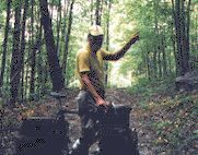
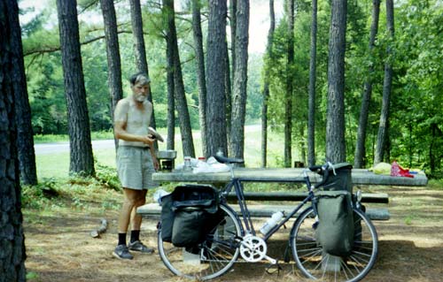
I spend an hour and a half here, cooking another meal with water from the pond. However, I can only eat half of it, a rare lack of appetite on this trip. This spot is not as cool as the other, as the sun shines through the trees, the picnic table is hot to the touch, and there is little breeze. [Note: The photo is not very flattering, but it clearly shows that I am suffering from the heat.]
I next ride a longer distance down to the homestead area, where I can get cool water from a tap. I drink water, fill my bottles, wet my shirt and bandana, and start out again for the final stretch.
I don't even try to pedal the steepest hills because I am avoiding getting too hot. The temperature is up to 102°, and the air is humid. Fortunately, with the sun lower in the sky, I am getting some shade now, which I need badly. Today I have counted five hills which I descended at 30 mph or faster, the steepest 34.5 mph. None are very high, and it seems that in traveling south that I am going mostly downhill. But that is impossible, as I started not much above the lake level. I am getting a lot of shade now, which I need badly.
Finally, I make it to the welcome center at closing time, but the woman inside encourages me to come in and fill my bottles with cold, filtered water. She says there have been heat warnings and advises me to get a motel.
I make it the last few miles to the supermarket, where I buy the fruit I have been craving all day along with other food. It occurs to me that my strong craving for fruit indicates that my electrolytes are depleted.
A man outside tells me that there are two motels, the one across the street and another which is probably cheaper. At the supermarket across the road (did you think I would stop only once?), the cashier offers to help me call both motels to check their prices. When I learn that the second one has a room for $30, I tell the manager to save it for me, and ride the last five miles with renewed energy.
On the way, I pass places where I could have camped, and I begin to blame the people for "forcing" me into a motel. But on reflection, I note that I was the one who mentioned "motel" to them. Considering that the temperature is still over 100° at six o'clock, would I be able to recover successfully for tomorrow if I camped in the woods? And tomorrow could be just as hot, although cooler weather is predicted.
By chance, I am able to watch Al Gore make his acceptance speech just as I was able to watch George W. Bush make his. Usually I don't sleep well in a motel, but this time I eat and eat and then sleep fast and hard.
LBL - Dover, Tennessee, 48.6 miles, 11.3 mph, August 17.
Day 79: In the morning, I want to play with the computer some before leaving the motel, and I look at some pages I want to revise, but I really don't have the energy and focus to do so now. I get up and get ready. The sky is overcast.
As I leave, it starts to rain and before I get to Dover, it starts raining hard, so I stop and get out my raincoat and put it on without zipping it up. I ride through town but don't stop for a drink until out of town, where I put the coat back up, the rain having ended.
This ride is rather pretty with lots of woods and limestone outcroppings. There is even a cave on the side of the road.
After stopping a second time for a drink and a snack, it starts to rain, first light and then hard. This time I ignore putting on the raincoat. The temperature is close to 80°, so I'm not going to die of a cold or anything. On the long ride to Tennessee Ridge, I pass several places where I could have camped.
At the supermarket in Tennessee Ridge, I ask about the route to Waverly, which I see as a short cut. After giving me the information, the people in the store want to know about my trip, and I tell them some things and then get off onto the subject of dangerous driving. Suddenly, I notice that I have half a dozen people paying careful attention to my every word, and I become suddenly embarrassed and stop. I guess I could never be a politician.
The "short-cut" to Waverly turns out to be all up and down hill and not a bit shorter, and it would have killed me in yesterday's heat, but it is a pretty route.
When I reach highway 13, I find it isn't a flat or as wooded as I remember; I probably remembered just the better parts as whole sections of the road are missing from my memory. For instance, I have no memory of Waverly at all.
In Waverly, I go to the library, but I can't use email and I can't find a good book. Nonetheless, it's 2:30 before I leave. I get a sub, some bean burritos, and some yogurt before I leave the town.
The rest of the route is more wooded, as I remembered. State forest is mostly on the right and private land mostly on the left. After crossing the Duck River and traveling several miles, I realize that I will soon reach the interstate. Since there will be fewer good places to camp ahead, I begin looking for a camping site, even though I haven't traveled my 60 miles. I choose a section that has state forest land on both sides. The right side is steeper, but it has occasional dry stream beds. I see one such bed that is well-hidden by trees, so I push the bike up the stream bed about 100 feet. Unfortunately, at this point a gnat plays kamakazi with my eyeball, so I have to get out the mirror and bandana and play around with my eye for a while to get the gnat out.
I pitch the tent on the flat stream bank and rest a while before I get inside. The temperature has dropped from 92° to 80°, but the tent is still stiflingly hot. I would leave the tent flap open, but no-see-um's or some similar invisible insects keep biting me, so I have to close it. I hear a deer snorting at me, but it won't come any closer.
Dover - Buffalo, 55.3 miles, 11.8 mph, August 18.
Day 80: I awaken while dreaming about my website plans and automatically start correcting errors in my thinking. It's not until after I've dressed that I realize what I was doing. This looks like an excellent day. The sky was clear last night, so the morning is cold. While I'm thinking that this will be a perfect day, my nose stops up, and I start sneezing and coughing. It might be my reaction to the cold morning air, or it may be a sign that I've reentered familiar allergen territory.
I get up and going. The temperature outside is about 66°. Up the next hill and down the other side brings me to the interstate, with four motels and all kinds of eating places. I stop for a drink, but the prices are high, so I decide I can wait, especially since I've just had three large bananas.
I ride on to Lobelville, where a can drink is still 69¢, but I can get a small packet of cookies for 50¢. I talk with two men also eating there about a TV program on which someone is letting his dog lick his face while explaining why dogs smell each other; we are all grossed out by that. When I go outside, one of the men is filling his thermos for work, and he offers me the rest of his ice, which I put in my wide mouth bottle.
I then head down to Linden. This route is hillier and less wooded than I remember, but the traffic is light, and there are lots of woods, so I'm still pleased with it. Nearing Linden, I can see several places to camp, while I couldn't find any ten years ago. I ride my bike up the hill to the old town (which I didn't do on the last trip), where I buy some cooked chicken, some fresh bread (69¢!), and some yogurt. While I'm eating outside on the bench, a fellow asks me if I had helped his sister with her bike the other day. He says that a cyclist from Alabama had helped her four days earlier. It could be another long-distance touring cyclist but, on the other hand, we are less than 50 miles from the Alabama line, so it could have been a day rider.
After eating, I ride down to Flatwoods, as it's not yet noon. I stop there to get a drink, and get treated with a strange story about running a Korean cyclist off of the road during the Korean War, perhaps to his death, from a man who both considers the incident funny and is eager to shake my hand when I leave.
I continue on to Waynesboro, stopping halfway there on a hill in the heat to eat some plums. I reach Waynesboro at two, having come 53 miles. Maybe I'm not so old after all. The temperature has helped because it still hasn't gotten above 94° all day, and the breeze has been lightly in my favor. Still, it has been a lot of hills on a hot day.
At Waynesboro, I get a sub and go by the library to rest and read, but the library is closed. So I stop to write in the shade, and I immediately get sleepy, so I take a nap that lasts over an hour. Then I write up my notes before starting again.
I now follow US 64 east, hoping I will have good shoulders all the way, as I do now. This route will shorten the distance back over the route I followed on my 1990 trip.
There are lots of woods around, and I see great places to camp up until the 65th mile, but I'm afraid that if I camp now, I won't get home until Monday, so I press on. I will probably have to camp in the state park, but it's worth a few dollars to save an extra day.
I pass under the Natchez Trace Parkway and continue eastward, making good time. I want to get to the park before dark, as state parks usually don't have anyone on duty at night. However, I find my tire is bumping, and I stop to give it some more air. A couple of miles farther, and it is bumping even worse, so I stop to fill it again. This time, the air rushes out of the value at high speed after I remove the pump. I have been having trouble refilling this tube for the last few days (it has had a very slow leak) because the value stem wouldn't depress; now the valve is stuck open. I move over into the shade of an empty building and remove the wheel and replace the tube, but I find I can't get the wheel back on because of the two washers that were added in Ontario. I keep trying, and suddenly I am furiously angry, wanting to destroy the wheel, the bike, or the bags. This is strange behavior on my part, as I never get angry, but the high temperature and hot evening sun are probably responsible. I move the bike to the wall, remove all the bags, and replace the tire. Now I will arrive at the park too late.
However, that is not the case. I arrive before dark, get assigned a place, meet the host, and go to the john while it is still light. The only thing I have to do in the dark is to put up my tent. My tent is in a fortunate position, as they isolated me from everyone else, as I prefer, and I only have to deal with vehicles constantly leaving and the heavy sound from a nearby sports stadium. Finally, the vehicles quit passing, the announcer's voice becomes obscure, and I drop off to sleep.
Buffalo - Davy Crockett SP, 80.8 miles, 11.8 mph, August 19.
Day 81: I wake in the morning before dawn, so I have to wait to get up. Then I go to the john and pack my stuff before hardly anyone is stirring. I am still hopeful that I can ride all the way home today, although the distance is probably over 100 miles. I put my leg warmers and raincoat on, as the temperature is cold, and I find myself sneezing again -- definitely a reaction to being chilly.
I stop at a convenience store in Lawrenceburg and get into a conversation with three men about stopping people on the highway. My argument is that it is OK for the police to stop people who are behaving strangely, but that they should not stop them on appearance alone. One of the three has long hair, so I tell a story about being stopped for that reason when I had long hair, and he gives some stories of his own.
Unfortunately, the good shoulders that existed before I got to Lawrenceburg don't exist between there and Pulaski. However, traffic is light, and the cool weather makes cycling easy, although I soon have to remove the leg warmers and raincoat.
In Pulaski, I stop at a Wal-Mart, where I get some nice small donuts at a good price and also some WD-40, my little can having run out. It does not occur to me to purchase another innertube.
I save a good bit of distance by avoiding the Pulaski bypass, but I have to climb a steep hill instead, something that might have happened going the other way as well. Once I rejoin the main road, I have an excellent shoulder, but the trip is not enjoyable. The road keeps climbing up and down major hills, actually small mountains until Fayetteville, and a hot wind is now blowing very hard to the south, which has me fighting a crosswind. The sun has become very hot as well. The most interesting feature of this part of the trip is studying the roadside cuts which have been blasted out of limestone, often over 50 feet high, with dolines and even caves sometimes visible.
As I am about to reach Fayetteville, my rear tire goes flat. I stop and look, and a piece of brown beer bottle has pierced it like a lance. At that point, an SUV stops, and the two people want to know if they can help me. Well, I know how to patch a tire, and I have two patch kits I haven't even opened yet, so I tell them to go on. However, the heat is intense, and the large patch I put over the three holes I find does no good. The tube doesn't even try to inflate with air, although my quick patch looks OK. Evidently, I have a massive hole or several holes elsewhere. In the broiling heat, I can not carefully remove the tire and inspect for holes in the direct sun, and there is no shade anywhere. And I have no spare tube. So I decide to walk on, hoping a Wal-Mart is close (it's Sunday, so a hardware store would not be open).
I walk a mile before I come to a convenience store. I ask a customer with an SUV about the location of a store, mentioning having turned down a ride I needed, and the fellow giving me directions says, "It's only a mile and a half." Well, that's a long walk in this heat. I get a wild idea and purchase an inflator kit for car tires which I use to inflate my tire with air and glue, then I take off for the store, but the tire goes flat within half a mile, and I am walking again. Now the tube gets in the way, so I have to semi-remove the tube for the wheel to turn. I try thumbing pickup trucks, but no one wants to stop. It's a long, hot walk to Wal-Mart, with one store along the way where I can get a drink. I get my tube and an extra tube, but the store lacks 27 inch tires. Replacing the tube is easy, as I have some good shade to work in. The gunk that I tried stopping the leak with fortunately left little mess.
Then I go down to the Taco Bell for some bean burritos. I would have gone to the Subway, but it is too tiny to have a bathroom, and my hands are filthy. I carefully wash my hands, having to provide my own soap, and then go out for some food. However, the manager says "no traveler's checks," the fourth place in 35 years to refuse them. So, I go eat a sub instead.
I lost an hour walking, half an hour changing the tire, and another half hour getting something to eat, so it is now four, and it seems that I can't make it home tonight. However, I head eastward on 64, and now I find that there are no shoulders, there is a fair bit of traffic, and I have some long steep hills ahead.
At five thirty, I reach my junction with 122, so I can get off of 64 and head for the Alabama line. But before I make the turn, I stop at the country store, and the owner is thrilled to meet me. It seems that another long-distance cyclist had stayed at the roadside park opposite and had aroused the owner's curiosity. So, we talk about touring, and he tells me that the park across the way is fine for camping. I think, "I'm fooling myself if I think I can get home tonight," so I check out the park, and I notice that the woods behind belong to the state as well (a sign reads, "No motorized vehicles beyond this point"). I push the bike in and find a less-obvious spot.
Davy Crockett SP - Junction 64/121, 66 miles, 11.2 mph, August 20.
Day 82: In the early morning, before any visible light, a deer is busy working the ground near me, as I also heard in Wisconsin. Without my making the slightest move, the deer is suddenly alarmed, sends a warning "whistle," and goes racing off.
As daylight approaches, I start getting ready, and I am up on the road at first light, stopping first at the store. Then I ride down 121 to 122. This second road illustrates a point about shoulders: although this road carries much less traffic than 64, it has a wide, excellent shoulder. Why? It was completed at a later date. The states that rebuild all of their roads frequently will be the first to have good shoulders on all their highways. These shoulders were not made for cyclists, but they do make it easier for us, since many motorists refuse to slow down.
I take 122 to Huntland, and from there I follow 97 towards Alabama. I see the same mountain my cabin is on to my east. In Alabama, it's called "Skyline Mountain" from the community on it; in Tennessee, it's called "Key Springs Mountain" for the same reason; on the topographic maps, it's shown as "the Cumberland Plateau." Rather than climb the mountain here, the road climbs over a saddle and then begins the descent of the Paint Rock Valley, which runs along the mountain's western flank. We tend to think of the streams as having created the terrain, but it's very obvious that the mountain is high above the surrounding land in both Alabama and Tennessee and is not the simple result of stream carving.
As I approach Alabama, I ride along a large field. The last time I rode this way, three deer started running parallel to my route through the field. Then I enter the Paint Rock Valley, which is prettier than many parks, although all in private land. The upper valley is very narrow, and there are few houses here. A young woman who was born here told me that when she was little, she considered it the end of the earth, and it very much has that feeling. The road mainly follows its old bed, and the last construction work, done in the 70's, has weathered and appears as old as the rest. The morning is still perfect for my ride, as the sky is overcast, the temperature still low, and there are even some low-lying clouds over the valley.
Finally, I reach the four-way junction that marks the beginning of the lower valley. From here, to get home, I have to climb a three-mile long, steep grade. It's mostly too steep for me to pedal with a loaded bike, although I do pedal up half a mile of it near the middle. Also near the middle is a rock bluff where I stop to rest a short while.
The top of the plateau is not hardly flat, and I follow the older road that parallels the main road, enjoying my slow parade home, rather than rushing. Finally, I reach the steep downgrade and then the turn down my own road, which unfortunately is the most poorly paved and the most badly littered road that I've been on this summer.
I arrive at my cabin at close to one o'clock. The trip is over, but not the day. I record my mileage and take my picture, unload some stuff, and look around a little. Then I head into town, so I can do some work at the library and get some supplies for the cabin: it will be another 26 miles of riding before the day is over. One adventure has ended, and another has begun.
Junction 64/121 - Cabin, 41.4 miles, 11.5 mph, August 21.
CONCLUSIONS: This was my roughest trip yet, mainly due to cold and rainy weather, but also due to some very hot weather at the end. The repeated early climbs in the Appalachians were difficult as well. This ended up being an expensive trip as well: $1,860 for 82 travel days and 90 total days, or $22.68 per travel day ($20.66 counting every day) and 41¢ a mile. For total cost, it was my most expensive trip, and for cost per mile, it was my second most expensive. The cost was three times as great as that of my 1998 trip, which covered a similar distance. The primary reason for the extra expense was the weather. I had expected higher than average costs along the Eastern seaboard, but I did not predict that my expenses would increase as the trip continued! The weather caused me to stop more at motels and to cook less. Motels were higher than on previous trips as well, I think encouraged by the booming economy. Everyone was wanting to cash in on the tourist trade, but tourists were few in most areas. In addition to problems caused by the weather, my lower daily mileage also increased costs. It took me 82 travel days to cover the same distance I had covered in 68 days two years earlier. While a higher daily mileage would not have decreased my cost per day, it would have decreased my cost per mile. Of course, my reduced daily mileage was partially caused by the weather, but I am also wondering if age has not become a factor. I noticed lower average speeds throughout the trip, and I have also noticed lower daily speeds since getting back.
The weather was most unusual in 2000, with late cold, rainy spells in the South, and later a complete blockage of the normal exchange of hot and cold air between northern and southern areas. As a result, Canada stayed wet and cold, as wet and cold as Alabama usually is during the winter. While not good for me, the cold summer was probably good for the ecosystem, which has been suffering from unnaturally hot and dry summer weather. At the same time, the Southeast experienced severe high temperatures and intense drought, which was not good for living things there.
All in all, the year 2000 trip was the worst solo trip I have ever made. The weather was worse, the pleasures were less, and the difficulties greater. In addition to the weather, I was quite disappointed with the Canadian forests, which had all been cut along this route. On the other hand, I had many good experiences, and I am glad that I made the trip. I only wish I had made the trip during better weather conditions. Nonetheless, if I had stayed home instead of making the trip, I would have experienced terribly hot weather instead. I think I can give myself a pat on the back for doing well under adverse conditions; however, some cyclists would have been less bothered by bad weather than I was.
|